
Thursday, October 31, 2013
DMTI Spatal: 2013 data updates
Received from DMTI Spatial, 2013 data updates for CanMap RouteLogistics, CanMap Water, CanMap Parks, CanMap Rail, Canadian Atlas, Neighbourhood Boundaries, Platinum Postal Codes and Enhanced Points of Interest (EPOI)


Friday, October 4, 2013
Greater Toronto Area: Orthoimagery 2009 - 1010
Received from Land Information Ontario, 2009/ 2010 orthoimagery for the GTA.
These digital orthoimages provide full-colour aerial coverage of Toronto core (10 cm), York (15cm), Caledon (20 cm), South Durham (20 cm), Brampton (10 cm), Mississauga (15 cm), and Oakville (10cm),
http://www.lib.uwaterloo.ca/locations/umd/digital/GTAImagery2009_2010.html

http://www.lib.uwaterloo.ca/locations/umd/digital/GTAImagery2009_2010.html

Wednesday, October 2, 2013
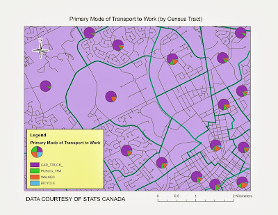
2011 NHS (National Household Survey) from Stats Canada
Received from Stats Canada, NHS (National Household Survey) 2011 census profiles for age/sex, aboriginal,
education/ labour, language, marital/ families/ households, mobility/ migration,
immigration/ ethnocultural/ diversity and are now available. Income and Housing
census profiles are expected to be released in the near future.
http://www.lib.uwaterloo.ca/locations/umd/digital/Statscan_Census.html
http://www.lib.uwaterloo.ca/locations/umd/digital/Statscan_Census.html

Wednesday, September 18, 2013
DRAPE (Digital Raster Acquisition Project for the East) 2008 - 2009 Imagery
Received from Land Information Ontario, the complete DRAPE (Digital Raster Acquistion Project for the East) dataset (2008-2009) for Eastern Ontario. 20km mosaics have 50cm resolution and stored in MrSid file format. Average file size is 1GB.
http://www.lib.uwaterloo.ca/locations/umd/digital/ssi/Drape.html

http://www.lib.uwaterloo.ca/locations/umd/digital/ssi/Drape.html

Tuesday, September 3, 2013
2008 QuickBird Satellite Imagery for the City of Waterloo
Obtained in August from Digital Globe, 2008
QuickBird satellite imagery for the City of Waterloo. The imagery Bundle (Pan
MS) is Multispectral, 4 bands (BIR, R,G, B) and was captured on May 29, 2008.
The 61cm geo-referenced imagery is available in GeoTiff 16 bit format.


Tuesday, August 27, 2013
Geospatial Centre welcomes Talsan Schulzke
Talsan’s main
responsibilities include:
- Offers geospatial reference and consultation services to library users
- Trains colleagues and library users in effective uses of GIS
- Assists in creating, maintaining, updating and organizing the Library’s Geospatial data collection.
- Assists in the development of relevant teaching and training materials for workshops, classroom presentations and special events
- Delivers and maintains geospatial digital and digitalization projects
Talsan holds a B.A. from Brigham Young University-Idaho,
where he majored in English and minored in geography. He moved to Waterloo from
Rexburg, Idaho, where he worked full-time for the City of Rexburg as a GIS
Analyst and taught freshman writing at BYU-Idaho on a part-time basis. As a GIS
Analyst, Talsan was responsible for maintaining the city-county enterprise
database (SDE) and also acted as chief cartographer for standardized map
publications. Although he had a variety of duties with the city, Talsan’s
primary responsibilities included database administration, GPS data collection,
utilities mapping, and emergency services support, including maps and
applications. Talsan looks forward to combining his GIS skills with his
enthusiasm for learning in providing geospatial support services at the
University of Waterloo.
Wednesday, July 31, 2013
Public Owned Parcels - Region of Waterloo
Received from the Region of Waterloo on July 22nd, parcel data displaying all public owned land within the Region. Parcel ownership is broken down by government agency (region, fed, provincial, etc.)


Subscribe to:
Posts (Atom)


