This data resource was downloaded from the City of MIssissauga Open Data Catalogue .
http://www.lib.uwaterloo.ca/locations/umd/digital/CityofMississauga.html


 Open data from the Ontario Ministry of the Environment, includes: water wells, provincial groundwater monitoring network, drinking water surveillance program, drinking water, hazardous waste, ontario forest biomonitoring network, provincial water quality monitoring network, etc..
  Received from Land Information Ontario in February 2012, this 2009 data provides detailed attribute information on soil type in South, East, and parts of Northern Ontario. Scale of the data is 1:50,000 and is available by census division.
 The Map Library has recently received from Land Information Ontario the Ontario Radar Digital Surface Model (DSM), created by using spaceborne C-Band Interferometric Synthetic Aperture Radar (IFSAR) data. The current provincial digital elevation models cover only the southern half of Ontario with little for North Boreal or Lowland coverage. This Radar DSM will fill in the provincial elevation data gap and extends north from 49 degree latitude north..
 Open data for the Region of Waterloo, includes: garbage collection schedule zones, cycling paths, green bin schedule zones, recycling schedule zones, regional boundary, rivers, settlements, GRT routes and stops, and yard waste schedule zones.
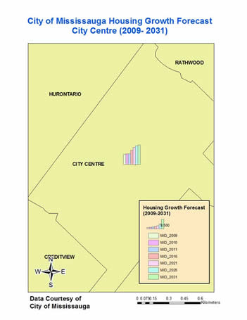
 Open Data for the City of Mississauga. Data categories include Landuse, Development, Employment, Census, Administrative, Environment and Growth Forecast. File formats are SHP, KML, CSV and PDF.
  Free vector and raster map data at 1:10m, 1:50m, and 1:110million scales, designed to meet the needs of production cartographers using a variety of software applications.
 Scholars GeoPortal is a geospatial data discovery tool allowing Ontario’s university students and researchers to enrich their teaching and research by engaging with OCUL’s growing collection of geospatial data. The portal offers search, preview, query, download and sharing functionality for datasets licensed by Ontario university libraries, covering such topics as land use, transportation networks, census boundaries, geology, soils, points of interest (such as healthcare facilities, schools, and airports), air photos, and more.
 Land Use Information Maps for the District of Mackenzie, Northwest Territories. Map series shows wildlife areas, hunting and trapping, fish resources and fishing, recreation - tourism, forest resources, etc.
 The Map Libary has received from the Region over 40 new new data sets including, aggregate licenses, airfields, contours, forests, arts facilities, garbage routes, green bin Routes, medical centres and yard waste collection routes.


